
GIS Day at the Capitol
2010 Photos |
Click on the photo to see a larger version.
4-H_2.JPG |
4_H.JPG |
acog.JPG |
ag_group.jpg |
benchmark_gps.JPG |

callokie_2.JPG |

call_okie.JPG |
carter_county.JPG |
chickasaw_4.JPG |
chickasaw_nation.JPG |
chickasaw_nation_2.JPG |
chickasaw_nation_3.JPG |
city of broken_arrow.JPG |
city_ardmore.JPG |
city_ardmore_2.JPG |
city_broken_arrow_3.JPG |
commerce.JPG |
commission_employees.jpg |
corp_comm_2.JPG |
crowd_1.JPG |
crowd_11.JPG |
crowd_12.JPG |
crowd_13.JPG |
crowd_14.JPG |
crowd_15.JPG |
crowd_2.JPG |
crowd_3.JPG |
crowd_5.JPG |
crowd_6.JPG |
crowd_8.JPG |
crowd_9.jpg |
csa.JPG |
Dept_of_Health.JPG |
deq.JPG |
deq_3.JPG |
deq_4.JPG |
deq_group.JPG |

ecad.JPG |
enercon.JPG |
esri.JPG |
flint_Hills.JPG |
flint_hills_2.JPG |
flint_hills_3.JPG |
flint_hills_4.JPG |
geo_comm2.JPG |
health_crowd.JPG |
health_group.jpg |
incog_2.JPG |
meshek.JPG |
mineral_and_energy.JPG |
mntc.JPG |
muscogee_creek.JPG |
odmhsas.jpg |
odot.JPG |
OK_county.jpg |
ok_county_2.JPG |
ok_county_group_2.JPG |
ok_geology.JPG |
owrb_2.JPG |
owrb_3.JPG |
owrb_4.JPG |
pictometry.JPG |
R7solutions.JPG |
red_plains.JPG |
scaug.JPG |

stacia_shellie.JPG |
surdex.JPG |
tinker_environmental.JPG |
tinker_environmental_2.JPG |
tinnker_igis.JPG |

topographic.JPG |
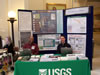
usgs.JPG |
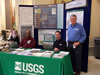
usgs_2.JPG |
usgs_3.JPG |
wildlife.JPG |
wildlife_2.jpg |